Coast to Coast 2022 Adventure Day 2: Eugene, OR to Sisters, OR
This post is part of a series detailing my 2022 coast to coast cycling adventure.
Day 2 took us on one of the most beautiful, magical, grueling, exhilarating roads I have ever experienced — the McKenzie Pass - Santiam Pass Scenic Byway.
Day 2 Highlights:
Song of the day: Time Tough (AKA Higher and Higher) by Toots and the Maytels (my favorite climbing song)
Start: Eugene, OR
End: Sisters, OR
Distance: 99.16 miles
Elevation: 5,764 ft
Breakfast: Breakfast sandwich from Forresters Bar & Grill
Lunch: PB&Js and chips
Dinner: Pasta, sausage, salad in our BNB and Sisters SweetEasy ice cream
Today was really the anchor point for the start of the trip. I wanted to start in Oregon so that I could once again ride the McKenzie Pass - Santiam Pass Scenic Byway (AKA McKenzie Highway). I rode it in 2020 with my brother and son and it was amazing. It features a 4,000 ft climb, beautiful Oregon conifer trees, burn areas from the 2020 Holiday Farm fire, an other-worldly ride across a mile-high lava field, still-present snow from last winter’s unmelted drifts, incredible mountain peak views, and a thrilling 2,000 ft descent into Sisters. Heavy snows this winter threatened to delay the opening of the road but it did, right on time, last Monday.
It’s hard to understand a ride like this when you haven’t done it before so I’ll try to describe it. It starts out as a map and some numbers that give you pause. In this case, nearly 100 miles and 5,500 feet including a 4,000 ft climb in a 32 mile stretch. You have to plan mentally, as well as physically for this kind of climb. First of all, you have to find a gear, usually the lowest “granny gear” with occasional time in 2 and 3, that you can stay in indefinitely. One approach I like to take is to either tell yourself you are going to be riding at this pace “for the rest of the foreseeable future,” sort of like a purgatory that you can deal with. Or break the climb into milestones and only think about one at a time. In this case I chose the latter since there are signs at 2,000, 3,000, 4,000, and 5,000 ft. Your mind wants to drift to the enormity of the entire task, especially at the beginning of the climb, but you have to take it one step at a time.
When you hit the half-way point, you tell yourself “OK, I’m half way done. I still feel pretty good and I need to just do what I did again.” This of course assumes that you have done the training to be physically ready. But even if you have, the task can feel overwhelming and at times you ask yourself “why do I do this?” and swear that you’ll never do it again.
As you pass the three-quarter mark (in this case 4,000 ft) you start to feel a boost, knowing you are getting close. You start to see the landscape change. The endless switchbacks are slowly replaced with glimpses of the top that feel approachably close. And you get glimpses of the vista below, laying out for you what you have accomplished so far. Both give you a shot of energy.
When you finally, FINALLY see the road ahead of you level off, there is a huge sense of relief and accomplishment. And when you can switch to higher gears and pedal on level ground, and even coast, it feels great! You stand up and stretch your legs and get your butt off the saddle and it feels wonderful. Your first reward is the incredible landscape and views from the top. On the McKenzie-Santian Byway are lava fields that abruptly start out of nowhere, and views of the Three Sisters, Bachelor, Hood, and other peaks. Your second reward is the descent down the other side, in this case a 2,000 ft, 15 mile thrill ride into Sisters. As you swoop down and around each curve, with wind in your face and the beautiful vista in your eyes, and you swear that you are actually flying, you know why you do this. And you know that you are going to do it again at the first opportunity. In our case tomorrow.
On a more mundane note, my Garmin GPS is thoroughly borked. In talking to their support team, it turns out that they had a bad map update posted for two days and I just happened to catch that window and download it. It seems there is no way to revert and they are shipping me a replacement. Fortunately, today’s navigation was simple.
Here is a link to today’s ride:
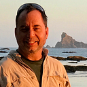
And some photos to capture the experience: